Click here to go back to the previous chapter
Kananaskis Country is a park system in the foothills of the Canadian Rockies that covers about 4,000 square km (a little over 1,500 square miles) on the other side of the mountains bordering Banff National Park, and about 20km from my host’s home in Canmore[i]. To put the size of this area into context, you could fit approximately 10 x Isle of Wights (each approximately 380 square km or 147 square miles) into Kananaskis Country. One of the reasons the area was established was to ‘alleviate congestion’ in national parks and offer greater recreation opportunities for local Albertans with its stunning natural landscapes and diverse outdoor recreational activities such as hiking, skiing, camping, and wildlife viewing.
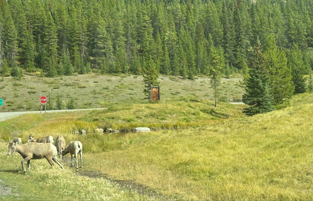
Sitting alongside the Bow River, which begins high in the Rocky Mountains, then winds down through the foothills, through Calgary, and onto the flat prairies to the East, Kananaskis Country is a tranquil and relaxing alternative to the busy National Parks. Tourists are scarce but any visitors to Kananaskis are likely to encounter moose, elk, deer, and bighorn sheep, as well as possibly large carnivores such as grizzly and black bears, wolves, and cougars.
The Spray Valley Provincial Park is run by the Canadian Province of Alberta, so is a much lower profile tourist destination that one of the well-known National Parks, are managed by the federal agency Parks Canada. In 2020, During the Covid-19 pandemic, the area saw a surge in visits, which almost doubled over the previous year and led to a corresponding increase in litter and traffic congestion, together with concerns that wildlife was being negatively affected by visitors unfamiliar with best practices, such as keeping to the trails and keeping their dogs on a lead. In 2021, the Alberta Government introduced access fees for anyone driving into and stopping in Kananaskis Country. This fee, known as a Conservation Pass, was intended to improve services and facilities, however some local people, including my host, believe that this is a form of economic discrimination which could exclude some people’s access to nature and outdoor recreational activities, which are not only beneficial for mental and physical health but are also important for overall well-being and education.[ii].
We parked up in a Day Use area at the foot of Mount Shark, where there was just one other vehicle, some picnic tables, a bear-proof waste bin, and a ‘long-drop’ public toilet. I was saddened to see an information sheet about a bear in the area who had recently been destroyed having become aggressive because of scavenging for human food.

I was briefed in how to look for fresh bear signs such as tracks, scat (faeces), and digs, which would indicate bear activity in the area. If the signs appeared fresh, or if there was any dead carrion, we would leave the area immediately. Should we actually encounter a bear, or other large carnivore, during the course of our hike, it was vital to remain calm and quiet, and not to attempt to run.
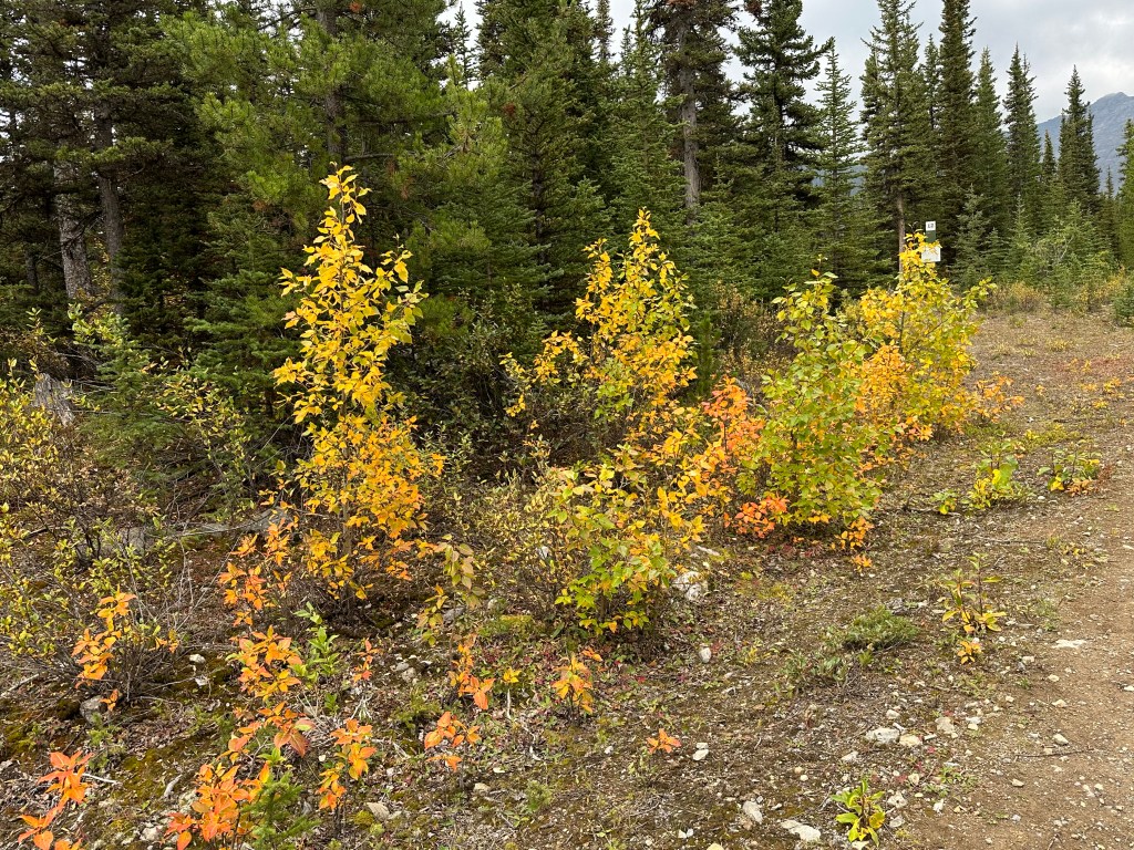
We set off along a wide, flat trail along an old logging road, clearly marked and bordered by low foliage beginning to show the first signs of autumn colour. There were distinct and fresh animal tracks along the edge of the trail, including hoof prints and paw prints about 10cm (4in) wide, presumably from a very large animal with paws and claws, but my host didn’t seem unduly concerned, so we continued.
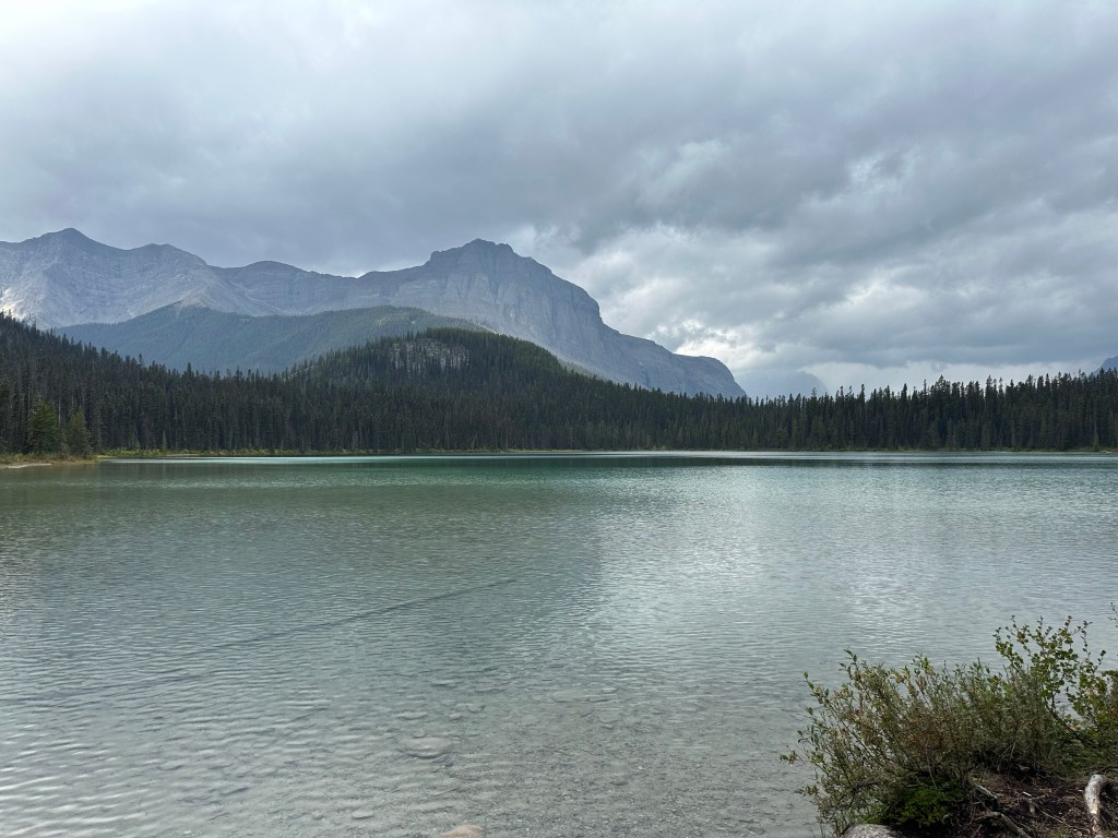
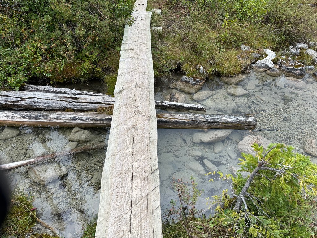
We crossed a rustic wooden bridge over a small river and entered a dry forest of pine trees. About half an hour later, we arrived at Watridge Lake, a sprawling body of water surrounded by mountains and forests. The lake was edged with stony wetlands, a section of which we crossed via a series of narrow plank walkways. Although moose regularly frequent this area, we didn’t spot any that morning.
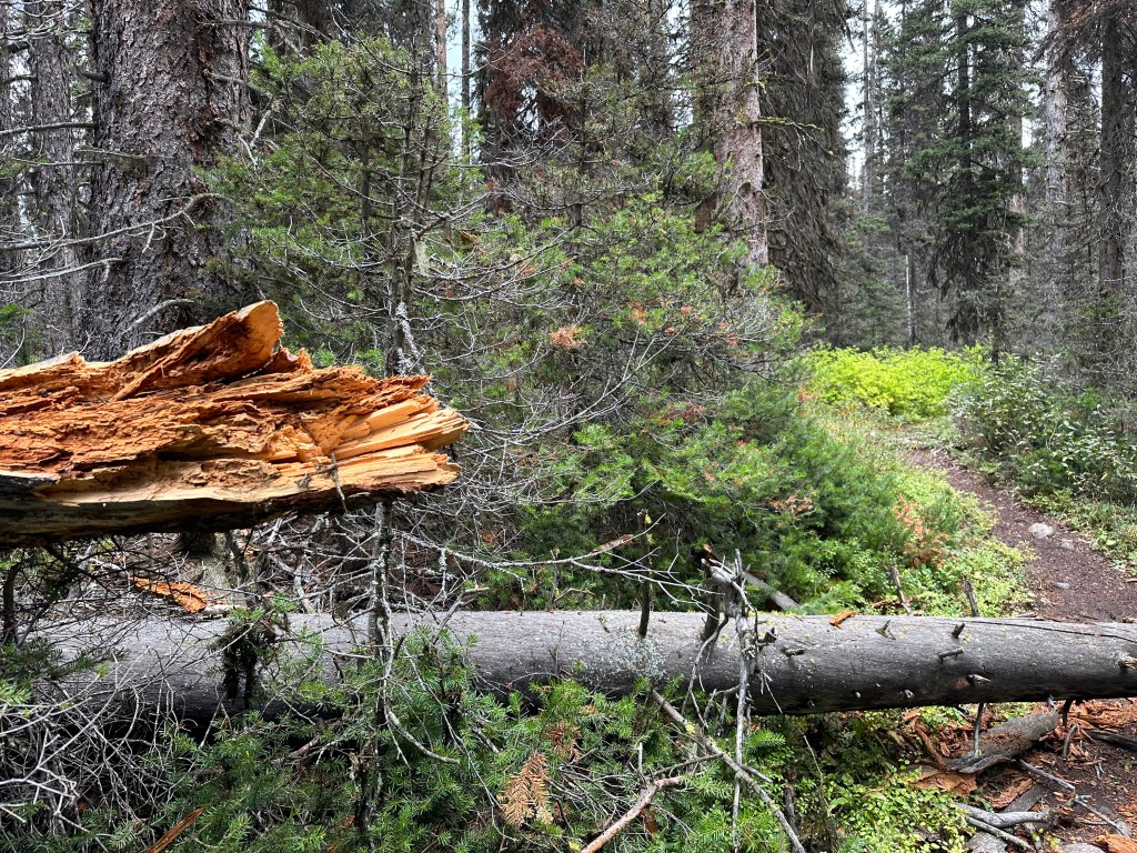
The terrain began to change dramatically as we left the flat open space around the lake and ventured into a lush, dense forest. The now narrow trail was intertwined with fallen trees that remained undisturbed, surrounded by towering ancient trees and moss-covered rocks along a briskly flowing stream. The eerie silence of the forest coupled with the gentle murmur of the water was a serene and enchanting combination.
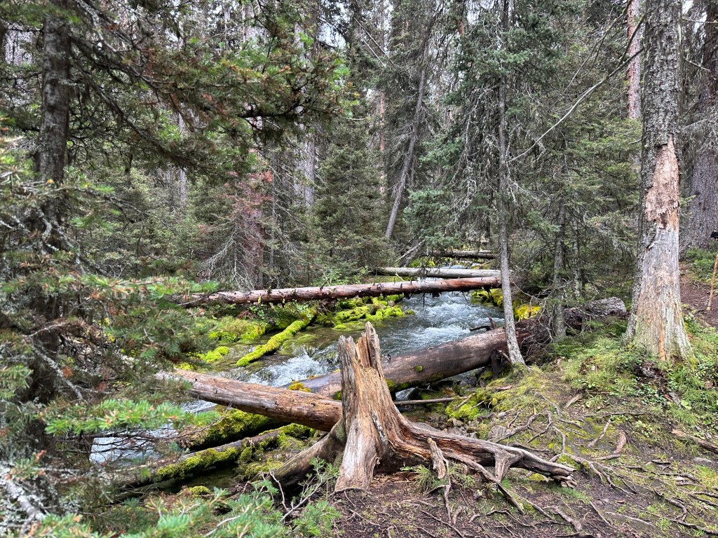
Soon, the uneven path began to climb steeply, and the sound of the rushing water became louder as the stream became a pounding torrent interlaced with fallen trees. Despite the absence of scenic views because of the thick woodland, the scenery was extraordinarily picturesque and mysterious.
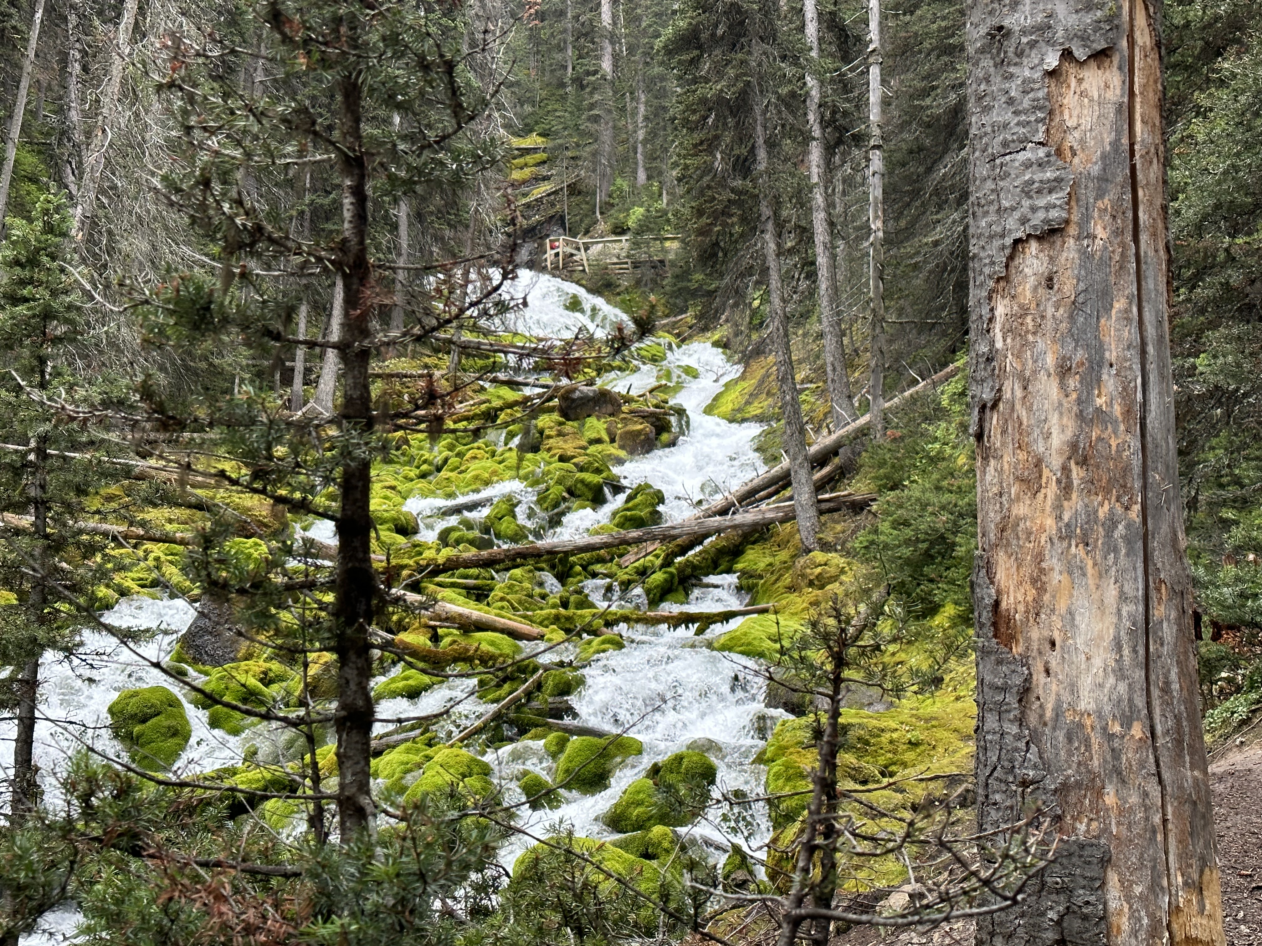
When we eventually reached the source of the water, known as Karst Spring, there was a well used but solid small wooden viewing platform from which to get close to the source of the water safely. Disappointingly, the handrail bore the marks of scarred graffiti, a disappointing reminder of the presence of other humans amidst the natural beauty.

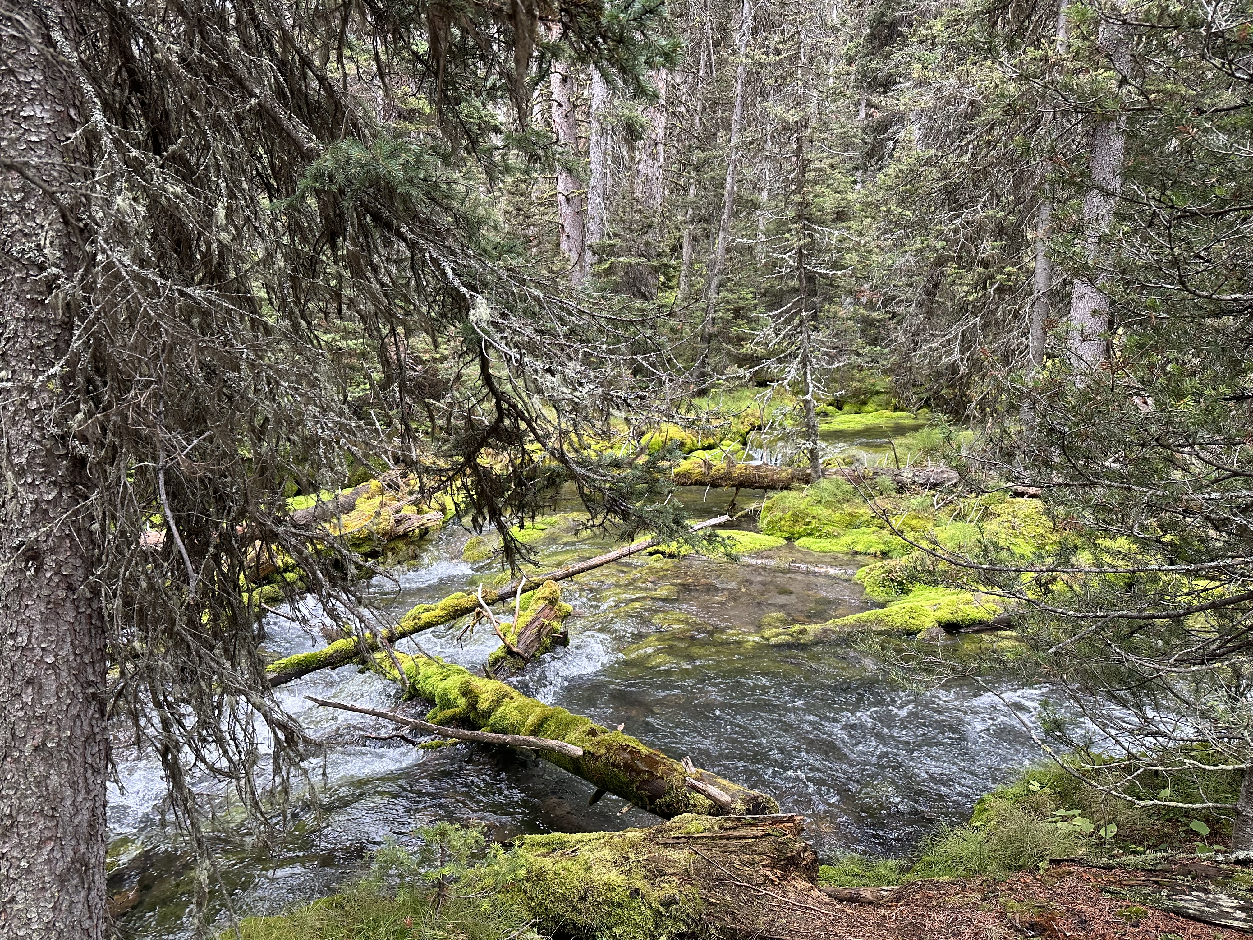
Karst Spring is a natural marvel where water has drained away from a much larger area and found its way into solid rock where, over thousands of years, it has eroded hollows spaces. These hidden caves fill with water, exerting pressure until the water eventually finds an escape route, creating a cascade of crystal-clear water which appeared to emerge from a solid rock face.

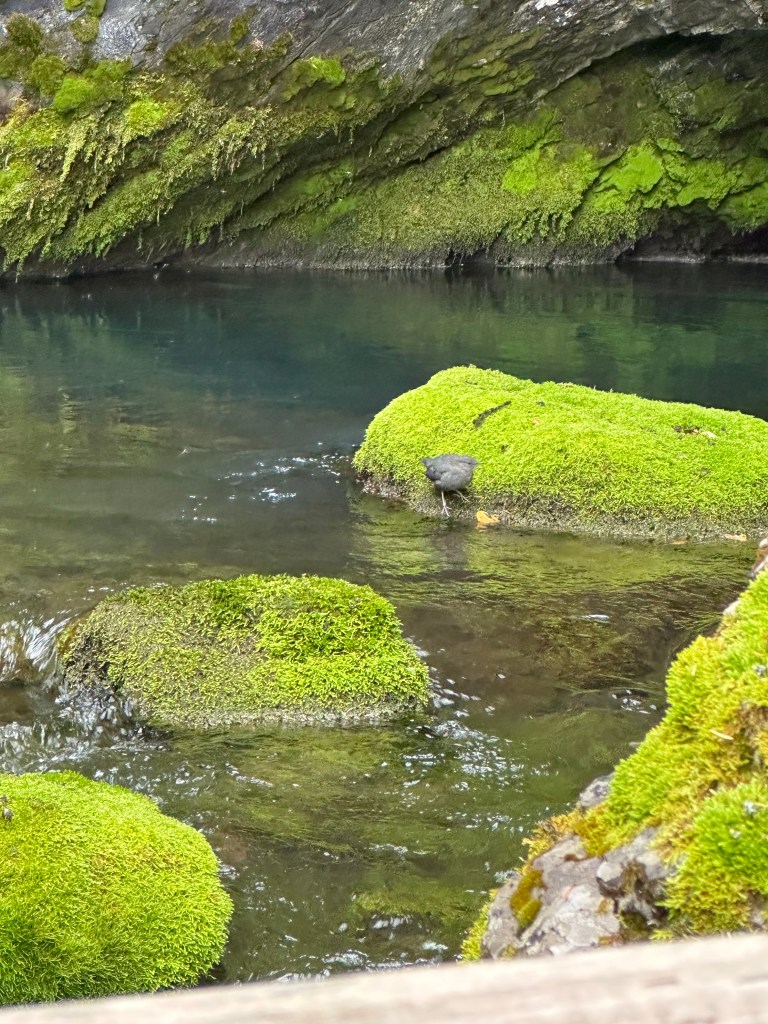
That morning, the only wildlife we saw were small ground and tree-dwelling mammals darting across the trail or in the trees, along with birds frolicking in the clear pools nestled among vibrant green moss-covered rocks.
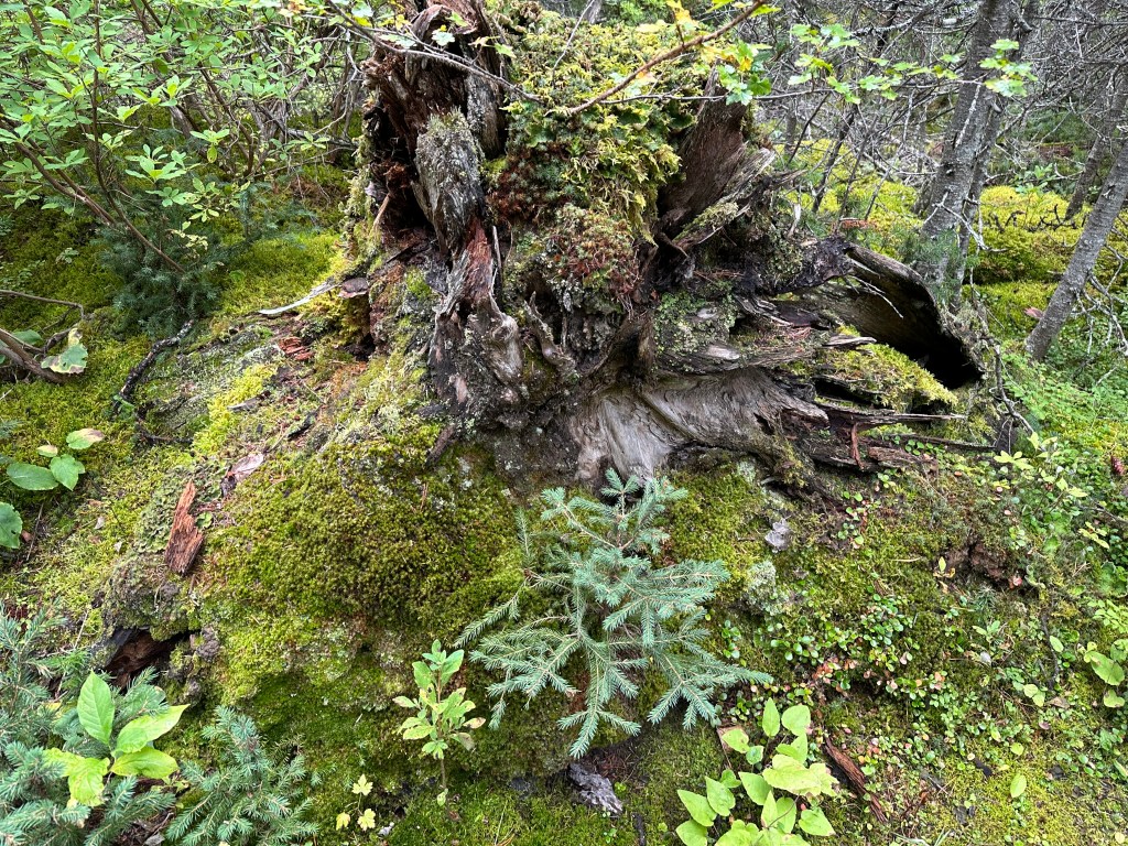
Karst Spring is a mesmerising natural phenomenon within a serene rainforest, well worth the strenuous climb and navigating the labyrinth of trees and roots left undisturbed by human intervention. Seeing new saplings taking root within the remains of dead trees was a powerful reminder of the cycle of life.
We returned the way we came and, as we reached the old logging road, we stopped and chatted briefly to a couple of young hikers in their early twenties. They were nearing the end of a challenging 5-day backpacking expedition from Sunshine Village, a location we had explored on my first day in the Rockies, to the striking peaks of Mount Assiniboine and then to Mount Shark. Mount Assiniboine, often referred to as the “Matterhorn of the Rockies,” stands as an iconic peak only accessible by helicopter or via a lengthy and challenging hiking trail. My host, despite being in his 80s, still very much hopes to have the opportunity to attempt that route one day.
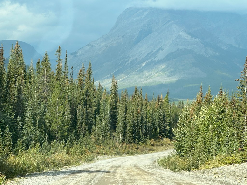
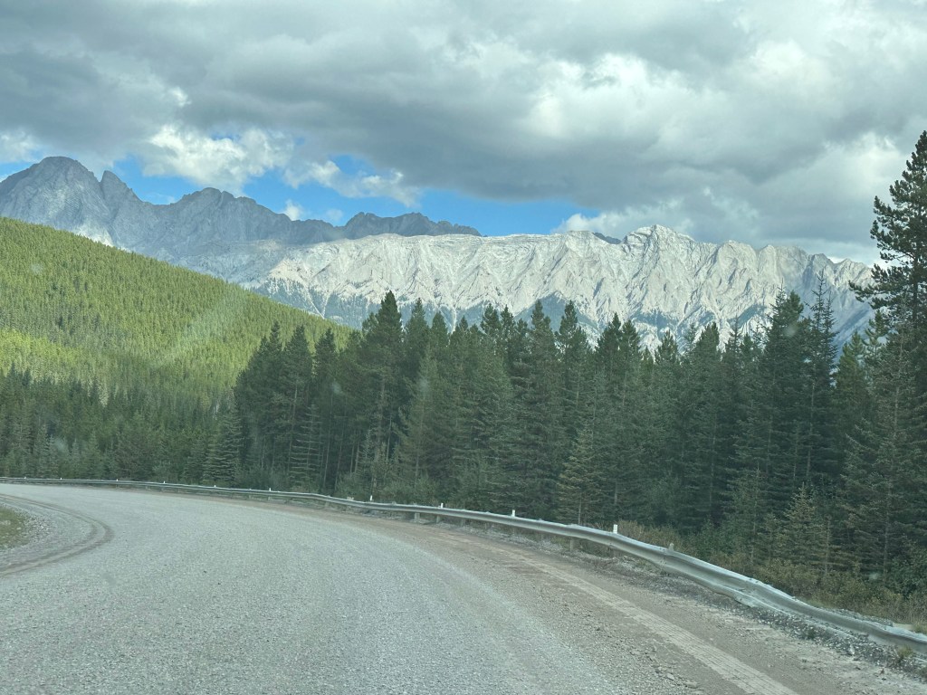
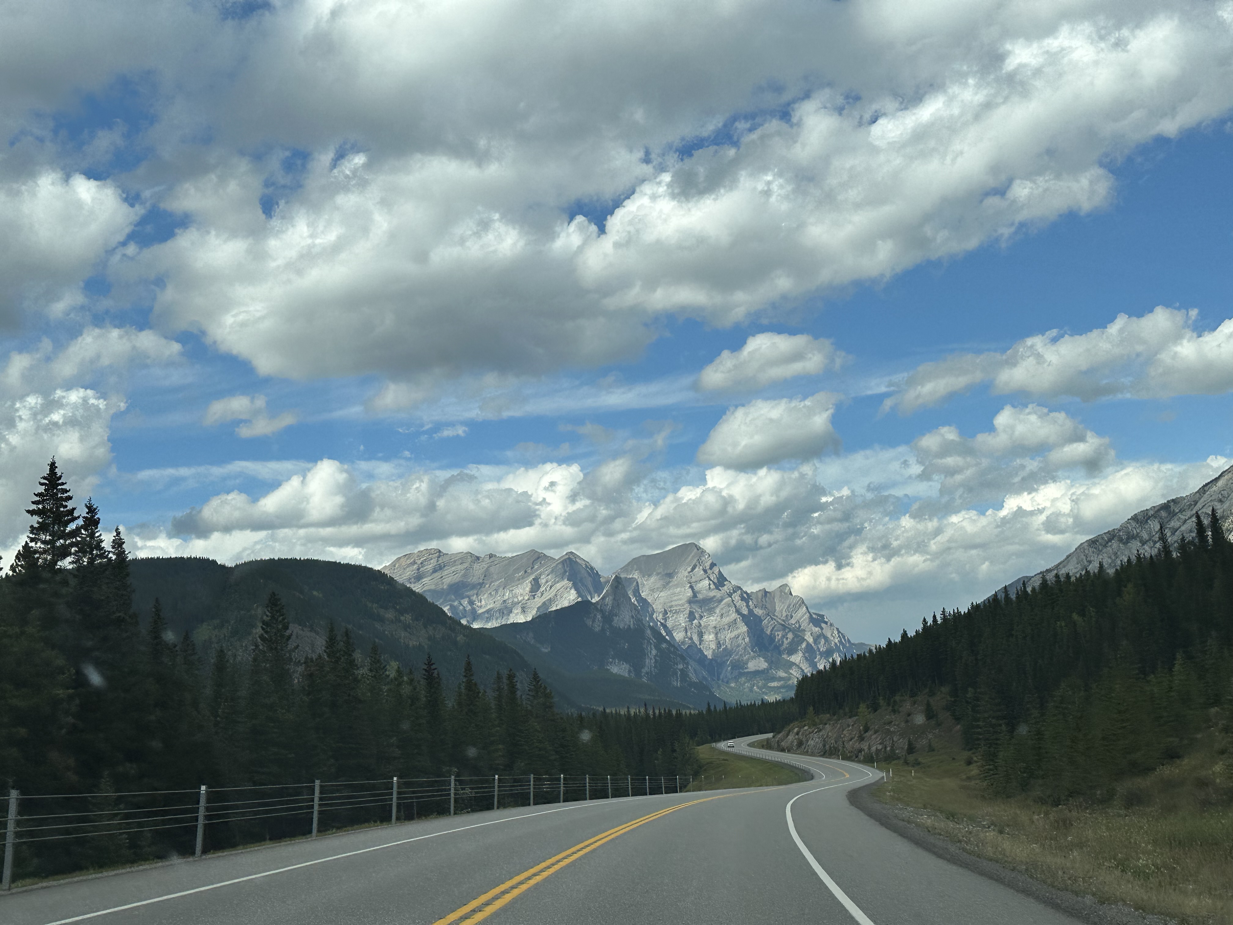
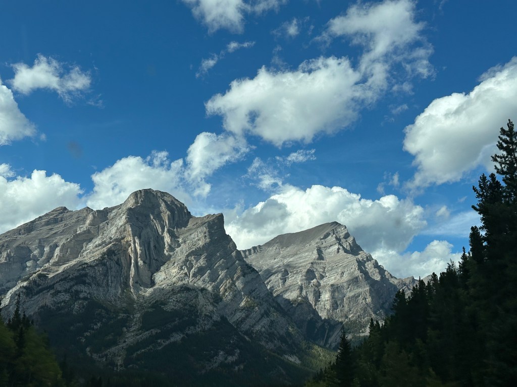
Having reached the car, we set off again along the Smith-Dorrien trail, a wide gravel road bordered by forests, majestic mountains, and some of the most spectacular views imaginable. In some places, the road’s edge was safeguarded by a battered armco barrier installed above perilous drops into the valley below. Tragically, some drivers underestimate the challenge of driving on gravel roads, leading to instances of loss of control with devastating consequences. The well-worn appearance of the barrier suggested it had prevented more than one disaster and served as a reminder for the need for caution in this rugged environment.
Vehicles travelling along these gravel roads generate massive amounts of dust but, despite leaving a cloud of dust in our wake, we were lucky to be the only car for miles, and not to be following anyone else that day.
Both grizzly bears and black bears are often seen along this route, but there were none that day, although we did pass a small herd of mountain goats, who completely ignored our presence.
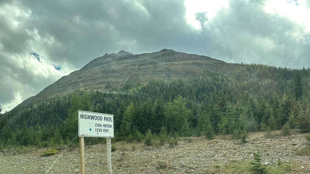
Back on a tarmac surface again, we headed along Highway 40 to the scenic Highwood Pass, the highest pass in the Rockies at 2206m (7239ft). Closed to vehicles from the beginning of December to mid-June to allow for the safe migration of wildlife, this is the highest paved road in Canada.
We were very lucky as the smoke from the fires in British Columbia had cleared (temporarily) so were rewarded with the most stunning and beautiful panoramic views of the surrounding mountains, valleys, and alpine meadows.
From the Highwood Pass, Highway 40 heads north up through Elbow-Sheep Provincial Park and back into Spray Valley Provincial Park.
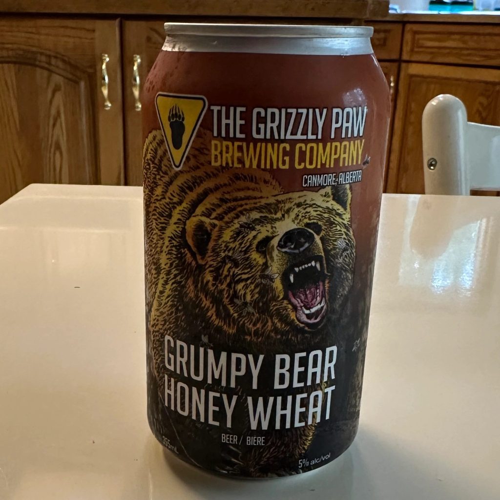
All in all, an extraordinary day experiencing the natural beauty of Kananaskis Country by road and trail, even though the only bear spotted that day was a refreshing Grumpy Bear beer from the Grizzly Paw Brewing Company of Canmore…
Click here to read the next chapter…
[ii] I have since been able to verify that there are some exemptions available for those of First Nations status, low-income Albertans, and residents of Kananaskis: https://www.alberta.ca/kananaskis-conservation-pass
